Boston Region Could See Six or More Inches of Snow
The cold, snowy, icy forecast in Boston for the next couple of days is a far cry from this time last year when temperatures reached a high of 74 degrees.
Although the first official day of spring is on Wednesday, March 20, locals are going to have to endure another round of snow (and temperatures in the 30s) before they can gear up for the start of the sunny season.
According to the National Weather Service, Boston and surrounding cities and towns will face “colder than normal conditions” mixed in with another winter storm on Monday night and into Tuesday.
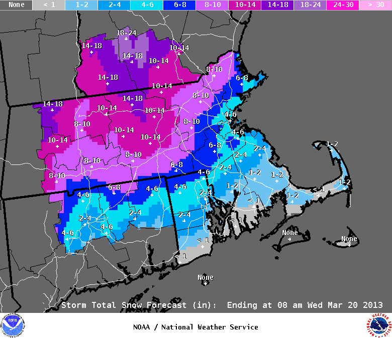
An official storm warning was issued by the National Weather Service on Monday for many parts of the Commonwealth, while a winter advisory was declared for Boston.
A “warning” means residents in the affected regions can expect to see six or more inches of snow in a 12-hour period.
An “advisory,” like the one for Boston, is forecast when snow or ice is expected to develop but snow accumulations will be on the lighter side.
“[The] storm will impact much of Southern New England,” according to the National Weather Service advisory.
The wintery weather will bring “sleet and some freezing rain” to most parts of Massachusetts, and is expected to blanket the city in some powdery white just days before the start of spring.
“There is a risk that Boston could end up with more snow than currently forecast,” according to officials from the NWS. The commute to work will hit those in Southern New England the hardest, as the highest weather impact rolls in on Tuesday morning, the advisory said.
The advisories will remain in place until 11 a.m. on Tuesday.