This Is What Boston Might Look Like After 2100 at Varying Carbon Pollution Levels
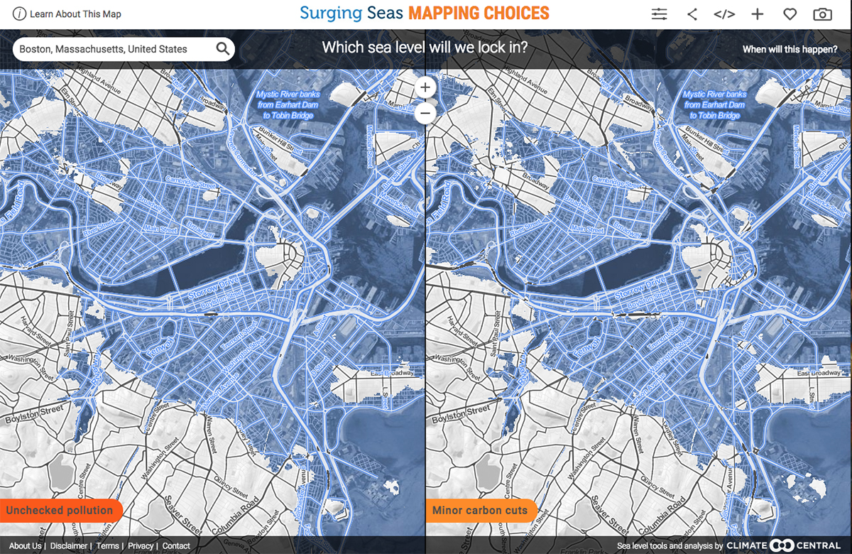
Boston at unchecked pollution levels in 2100 (left) and with minor carbon cuts (right). / Screenshot via Climate Central
To be quite frank, we’re in a lot of trouble.
Earlier this week, nonprofit news organization Climate Central released a new map tool, accompanied by a study in the Proceedings of the National Academy of Sciences, that illustrates the impact of rising sea levels in varying scenarios of carbon emission rates.
The map has two timeframe settings, showing predictions for 2050 and 2100. Scenarios include unchecked pollution (in which we maintain current rates of carbon emission) and carbon cuts ranging from minor to moderate to extreme.
Things don’t look great when you zero in on Boston—no matter which setting you choose.
Within 100 years, at unchecked pollution levels, it will be inevitable that all of the Fenway, the South End, and the Seaport District, as well as parts of Dorchester, South Boston, and downtown—save for a small island near the Common—will be submerged underwater. The time frame for such catastrophic flooding could be as soon as 200 years or it could take as long as 1,000 years, according to Climate Central.
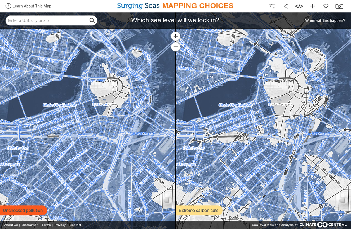
Screenshot via Climate Central
Currently the map only covers the United States, but will be extended globally in November. Check it out for yourself—we’re not the only city in trouble:
10/15/15, 9 a.m.: This story has been updated to clarify that rising sea levels may occur anywhere from 200 to 2,000 years from now.