MBTA Routes (and Delays) Now Included in Apple Maps
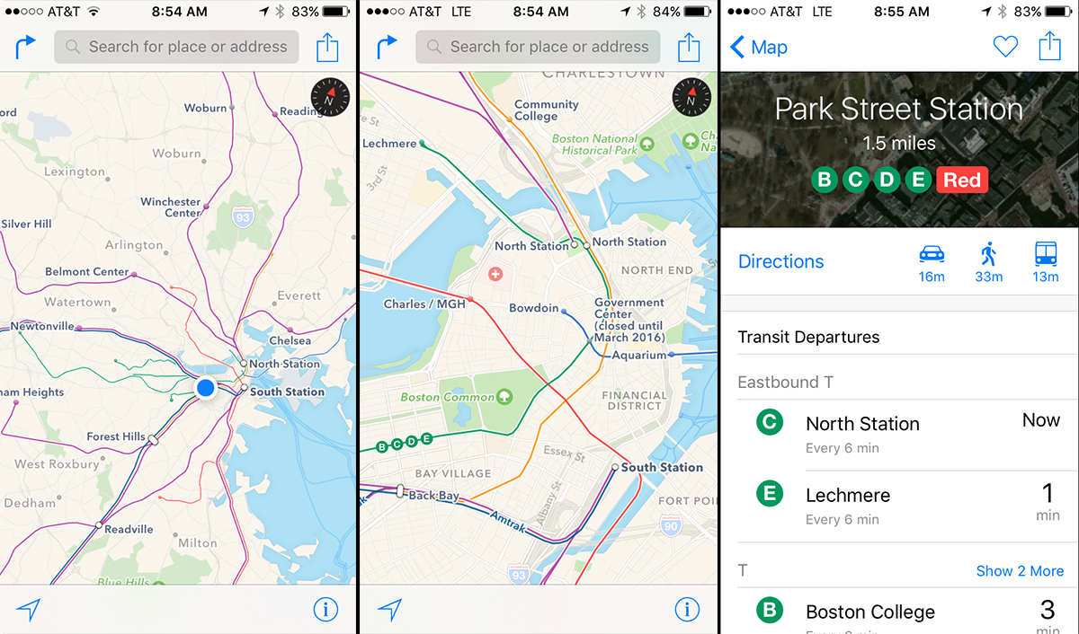
This may come as a shock, but in real life, the MBTA doesn’t quite follow the clean, brachiform lines of its ubiquitous map. The Green Line’s D branch, for example, extends far beyond the B and C branches, contrary to what the three neat termini on the map may suggest.
Starting Tuesday morning, you can view the MBTA’s true twists and turns as they relate to your trek through town in Apple Maps. The tech giant rolled out its new, expanded “Transit” feature for iOS9 users, adding support for metropolitan transit system schedules and information in Baltimore, Berlin, Chicago, London, Mexico City, New York City, Philadelphia, the San Francisco Bay Area, Toronto and Washington D.C., as well as over 300 cities in China.
For Boston, that means MBTA train and bus routes, Amtrak lines, and ferry ports.
Maps has come a long way since its introduction in June 2012, when Apple announced it would part ways with Google Maps as the default mapping service for iOS. A Tumblr page was devoted to all the glitches and other anomalies in iOS6 Maps, including directions for driving straight into the ocean or across an airport runway.
Who knows if Gov. Charlie Baker’s $82.7 million “Winter Resiliency Plan” will successfully prop up our battered MBTA through another snowy winter—one expected to be just as harsh as last year’s onslaught, if not worse. At the very least, you can see just how long your outbound train is delayed in a sleek, easy-to-read interface.