Beware the Super Bowl Parking Restrictions and Street Closures in Boston
How to get around when it goes down on Sunday.
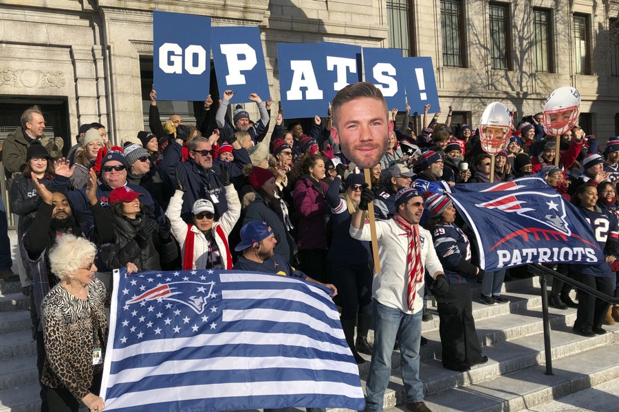
Workers at Boston’s Museum of Fine Arts rally outside in New England Patriots garb on Friday, Feb. 1, 2019 in Boston. The museum and Los Angeles’ J. Paul Getty Museum are trading a little trash talk ahead of the Super Bowl between the Patriots and the Rams. (AP Photo/Bill Kole)
If you’re planning on celebrating the Super Bowl in Boston this Sunday, make sure you’re paying attention to the parking restrictions and street closures that take will take effect the day of the big game.
In a pre-championship press conference Friday morning from the temporarily renamed “Belichick Room,” Mayor Marty Walsh announced that road closures will begin at 9 p.m. Sunday and continue until 1 a.m. Monday.
Tune in live at 10:00 am at https://t.co/2uhszJXi12 to watch our #SuperBowl Safety press conference ahead of Sunday’s game. #EverythingWeGot pic.twitter.com/7BMtMrGM8t
— Mayor Marty Walsh (@marty_walsh) February 1, 2019
The city also provided an update on security, noting that once police will have a presence in areas that, per experience, tend to attract a lot of revelers in situations like these. Kenmore Square will once again be off-limits to cars and pedestrians after the end of the third quarter. Thankfully, as a city of champions, we’ve gotten pretty used to winning, and the celebrations tend to go off pretty seamlessly. When the Sox won the World Series last year, there was only one arrest.
Walsh’s message to fans, regardless of team loyalty: “Just respect each other.”
As is tradition, Commissioner William Gross has already issued a letter to Boston-area students warning them not to do anything stupid—if anyone gets out of line during the post-gam celebrations, he’s even threatening to tell their deans.
Here’s what you need to know so you don’t get towed, per the city’s website:
Planned street closures in effect from about 9 p.m. – 1 a.m.
- Commonwealth Avenue, from the Boston University Bridge to Massachusetts Avenue, Both sides
- Brookline Avenue, from Beacon Street (Kenmore Square) to Pilgrim Road, *Vehicles in garages/parking lots that have no other exit to another public way will be directed in a southerly direction toward Park Drive
- Boylston Street, from Pilgrim Road to Westland Avenue
- Ipswich Street, from Boylston Street at Hemenway Street to Boylston Street at Park Drive
- Lansdowne Street, from Brookline Avenue to Ipswich Street
- Van Ness Street, from Ipswich Street to Yawkey Way, and from Jersey Street to Kilmarnock Street
- Jersey Street, from Boylston Street to Van Ness Street
‘No Stopping Boston Police Special Event Sunday’ parking restrictions in effect as follows:
BRIGHTON AREA- Brighton Avenue, both sides, from Linden Street to Allston Street
- Harvard Avenue, both sides, from Commonwealth Avenue to Cambridge Street
- Bay State Road, both sides, from Beacon Street to Granby Street
- Beacon Street, both sides, from Massachusetts Avenue to Park Drive
- Boylston Street, both sides, from Massachusetts Avenue to Brookline Avenue (including DCR areas)
- Brookline Avenue, both sides, from Beacon Street (Kenmore Square) to Pilgrim Road
- Burlington Street, both sides, from Brookline Avenue to the Dead End
- Commonwealth Avenue, both sides, both roadways, from Massachusetts Avenue to the Boston University Bridge
- Deerfield Street, both sides, from Commonwealth Avenue to Bay State Road
- Fullerton Street, both sides, from Brookline Avenue to the Dead End
- Granby Street, both sides, from Commonwealth Avenue to Bay State Road
- Ipswich Street, both sides, from Boylston Street at Hemenway Street to Boylston Street (Sunoco Gas Station)
- Jersey Street, both sides, from Park Drive to Brookline Avenue
- Kenmore Square (in its entirety), both sides, both roadways, from Kenmore/Raleigh Streets to Deerfield Street / Beacon Streets
- Kilmarnock Street, both sides, from Van Ness Street to Park Drive
- Lansdowne Street, both sides, from Brookline Avenue to Ipswich Street
- Newbury Street Extension, both sides, from Brookline Avenue to Charles Gate West
- Overland Street, both sides, from Brookline Avenue to the Dead End
- Park Drive (DCR Roadway), left side, left roadway (Roberto Clemente Park side) from Aggassi Road to opposite Kilmarnock Street
- Raleigh Street, both sides, from Bay State Road to Commonwealth Avenue
- Silber Way, both sides, from Commonwealth Avenue to Bay State Road
- Van Ness Street, both sides, from Ipswich Street to Kilmarnock Street
- Columbus Avenue, both sides, from Melnea Cass Boulevard to Douglas Park
- Hemenway Street, both sides, from Forsyth Street to Boylston Street
- Westland Avenue, both sides, from Hemenway Street to Massachusetts Avenue
- Congress Street, both sides, from New Chardon Street to State Street
- Hanover Street, both sides, from Congress Street to Surface Road
- New Chardon Street, both sides, from Cambridge Street to Merrimac Street/Congress Street
- North Street, both sides, from Surface Road to Congress Street
- Union Street, both sides, from North Street to Hanover Street
- Canal Street, both sides, from New Chardon Street to Causeway Street
- Causeway Street, both sides, from Merrimac Street to North Washington Street