New England has some of the most exquisite hikes in the world, offering adventure, fitness, and Instagram-worthy views. Here, we’ve selected 55 amazing hikes to try this year, from the bucolic fields of Middlesex Fells to the waterfalls of Maine. Our interactive guide features everything from mapped locations, to difficulty levels, to how far you’ll be driving from Boston. Plus, we’ve also created a cheat sheet on how to do it right—from foraging on the route to finding treasure boxes along the way. We also have hiking guides for summer, winter, and each season in-between. So grab your hiking shoes — it’s time to hit the trails. —Edited by Melissa Malamut and Kara Baskin
Hikes
Browse our list to find the best hikes in New England. Click on each to learn more about it.

Easy
-
Ipswich River Wildlife Sanctuary, Bunker Meadows Trail, Topsfield, MA
Ipswich River Wildlife Sanctuary, Bunker Meadows Trail, Topsfield, MA
Boasting 12 miles of trails through the North Shore’s forests, meadows, and wetlands, this retreat is a wildlife-lover’s paradise. Don’t be surprised if you see river otters, turtles, and eastern bluebirds along the Bunker Meadows Trail, which leads up to an observation tower with Ipswich River vistas.Level: Easy | Distance from Boston: 26 miles Topsfield, MA, 978-887-9264, website.
[caption id="attachment_2020656" align="aligncenter" width="630"]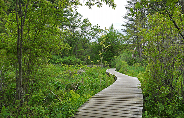 Photo courtesy of Camera-Lust on Flickr[/caption]
 Good for youngsters
 Bring the canoe/paddle board
 -
Pitcher Mountain Trail, Pitcher Mountain, Stoddard, NH
Pitcher Mountain Trail, Pitcher Mountain, Stoddard, NH
Kid-friendly Pitcher Mountain features a 2-mile loop hike flanked by blueberry and raspberry bushes. At the summit, you’ll find a climbable fire tower that offers vistas of the Green Mountains.Level: Easy | Distance from Boston: 106 miles Stoddard, NH, website.
[caption id="attachment_2020367" align="aligncenter" width="600"]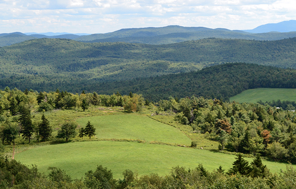 Photo courtesy of Josh Graciano on Flickr[/caption]
 Instagram-worthy views
Good for youngsters
Instagram-worthy views
Good for youngsters -
Bash Bish Falls, Mount Washington State Forest, Mt. Washington, MA
Bash Bish Falls, Mount Washington State Forest, Mt. Washington, MA
This four-season hike takes you to Massachusetts’ highest single-drop waterfall, a rocky 60-foot cascade.Level: Easy | Distance from Boston: 157 miles Mt. Washington, MA, 413-528-0330, website.
[caption id="attachment_2020402" align="aligncenter" width="600"] Photo by Jonathan Kozowyk for Boston Magazine[/caption]
Instagram-worthy views
Good for youngsters
Photo by Jonathan Kozowyk for Boston Magazine[/caption]
Instagram-worthy views
Good for youngsters -
Sleeping Giant State Park, Tower Trail, Hamden, CT
Sleeping Giant State Park, Tower Trail, Hamden, CT
Six trails run through this park, but if you’re looking for views of New Haven and Long Island Sound, take the 3-mile roundtrip Tower Trail to the stone observation tower.Level: Easy | Distance from Boston: 126 miles Hamden, CT, 203-287-5658, website.
[caption id="attachment_2020403" align="aligncenter" width="600"]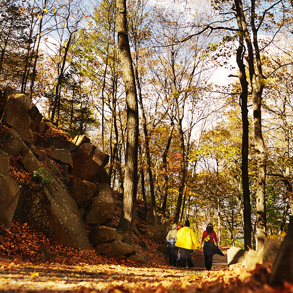 Photo by Jonathan Kozowyk for Boston Magazine[/caption]
Instagram-worthy views
Good for youngsters
Photo by Jonathan Kozowyk for Boston Magazine[/caption]
Instagram-worthy views
Good for youngsters -
Blue Trail, Charles Ward Reservation, Andover, MA
Blue Trail, Charles Ward Reservation, Andover, MA
The 2.2-mile hike in the Ward Reservation travels along three hills: Boston, Shrub, and Holt (the highest point in Essex County).Level: Easy | Distance from Boston: 25 miles Andover, MA, 978-689-9105, website.
[caption id="attachment_2020406" align="aligncenter" width="600"]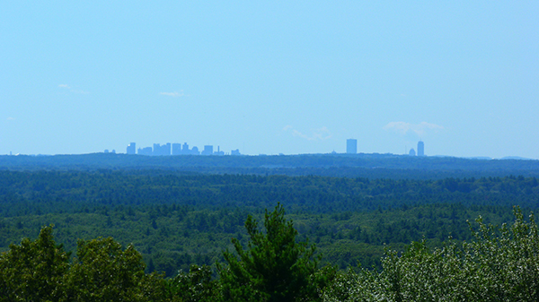 Photo courtesy of Sean Bentham on Flickr[/caption]
Good for youngsters
Photo courtesy of Sean Bentham on Flickr[/caption]
Good for youngsters
 Trails for two-wheelers
 -
Cliff Walk, Newport, RI
Cliff Walk, Newport, RI
With the roaring Atlantic on one side and historical Gilded Age architecture on the other, this 3.5-mile trek offers plenty of eye candy.Level: Easy | Distance from Boston: 73 miles Newport, RI, 401-845-5300, website.
[caption id="attachment_2020404" align="aligncenter" width="600"]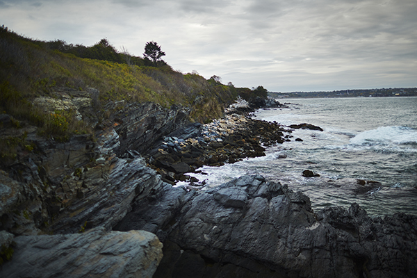 Photo by Jonathan Kozowyk for Boston Magazine[/caption]
Instagram-worthy views
Photo by Jonathan Kozowyk for Boston Magazine[/caption]
Instagram-worthy views -
Tyler Trail, Mount Pisgah, Northborough, MA
Tyler Trail, Mount Pisgah, Northborough, MA
This .76-mile trip up Mount Pisgah provides vistas of the Prudential and Hancock buildings on a clear day.Level: Easy | Distance from Boston: 41 miles Northborough, MA, 978-443-5588, website.
[caption id="attachment_2020407" align="aligncenter" width="600"] Photo by BCPNYC on Flickr/Creative Commons[/caption]
Instagram-worthy views
Trails for two-wheelers
Photo by BCPNYC on Flickr/Creative Commons[/caption]
Instagram-worthy views
Trails for two-wheelers -
Easthead Loop, Myles Standish State Forest, Carver, MA
Easthead Loop, Myles Standish State Forest, Carver, MA
This easy 2.5-mile path within the Myles Standish State Forest circles around the East Head Reservoir and features lush vegetation.Level: Easy | Distance from Boston: 55 miles Carver, MA, 508-866-2526, website.
[caption id="attachment_2020409" align="aligncenter" width="600"] Photo by Logan Ingalls on Flickr/Creative Commons[/caption]
Trails for two-wheelers
Photo by Logan Ingalls on Flickr/Creative Commons[/caption]
Trails for two-wheelers -
Colt State Park, Bristol, RI
Colt State Park, Bristol, RI
Four miles of flat, paved bike trails loop around a park equipped with picnic tables and playing fields, then opens to views of Narragansett Bay.Level: Easy | Distance from Boston: 67 miles Bristol, RI, 401-253-7482, website.
[caption id="attachment_2020410" align="aligncenter" width="600"] Photo by Dan Connolly on Flickr/Creative Commons[/caption]
Trails for two-wheelers
Photo by Dan Connolly on Flickr/Creative Commons[/caption]
Trails for two-wheelers -
Nelson Pond Trail, Norman Bird Sanctuary, Middletown, RI
Nelson Pond Trail, Norman Bird Sanctuary, Middletown, RI
This 1.4-mile stroll within the Norman Bird Sanctuary is situated on an important bird migration route and attracts a diverse range of species, including swallows and warblers. Guided bird tours are offered every other Sunday.Level: Easy | Distance from Boston: 70 miles Middletown, RI, 401-846-2577, website.
[caption id="attachment_2020411" align="aligncenter" width="600"] Photo by Lin Mei on Flickr/Creative Commons[/caption]
Good for youngsters
Photo by Lin Mei on Flickr/Creative Commons[/caption]
Good for youngsters -
Great Swamp Management Area, West Kingston, RI
Great Swamp Management Area, West Kingston, RI
This flat, 5-mile trail is inhabited by diverse wildlife such as the prothonotary warbler, a unique yellow-and-gray bird. At 3,350 acres, it’s the largest swamp in New England.Level: Easy | Distance from Boston: 78 miles West Kingston, RI, 401-789-0281, website.
[caption id="attachment_2020412" align="aligncenter" width="600"] Photo by Peter Rintels on Flickr/Creative Commons[/caption]
Trails for two-wheelers
Photo by Peter Rintels on Flickr/Creative Commons[/caption]
Trails for two-wheelers -
Breakheart Loop, Exeter, RI
Breakheart Loop, Exeter, RI
Breakheart Loop is a wide, 3.7-mile trail that wraps around Breakheart Pond.Level: Easy | Distance from Boston: 80 miles Exeter, RI, 401-539-2356, website.
[caption id="attachment_2020413" align="aligncenter" width="600"] Photo by enjoiskate8 on Flickr/Creative Commons[/caption]
Good for youngsters
Photo by enjoiskate8 on Flickr/Creative Commons[/caption]
Good for youngsters
 Dogs welcome
Trails for two-wheelers
Dogs welcome
Trails for two-wheelers -
Mattabesett Trail, Mattatuck State Forest, Middletown, CT
Mattabesett Trail, Mattatuck State Forest, Middletown, CT
Along the 215-mile New England Trail that runs through Connecticut and Massachusetts, catch the 5-mile section of the Mattabesett between Route 77 and Route 17 to reach Bluff Head, a promontory from which you can see Long Island Sound and the Coginchaug Valley.Level: Easy | Distance from Boston: 126 miles Middletown, CT, 203-457-9253, website.
[caption id="attachment_2020416" align="aligncenter" width="600"] Photo by Lisa Jacobs on Flickr/Creative Commons[/caption]
Instagram-worthy views
Good for youngsters
Photo by Lisa Jacobs on Flickr/Creative Commons[/caption]
Instagram-worthy views
Good for youngsters

Moderate
-
Middlesex Fells Reservation, Skyline Trail, Stoneham, MA
Middlesex Fells Reservation, Skyline Trail, Stoneham, MA
Eleven hiking trails of varying difficulty traverse this 2,575-acre park. Take the popular 6.9-mile Skyline Trail to the observation tower atop Pine Hill, where you’ll enjoy city and harbor views.Level: Moderate | Distance from Boston: 10 miles Stoneham, MA, 617-727-5380, website.
[caption id="attachment_2020428" align="aligncenter" width="600"]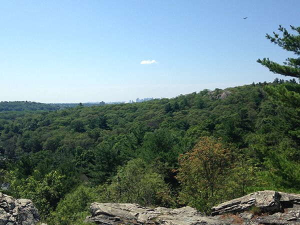 Photo by Asia Bradlee[/caption]
Instagram-worthy views
Dogs welcome
Photo by Asia Bradlee[/caption]
Instagram-worthy views
Dogs welcome -
Harold Parker State Forest, Hiking/Bridle Trail, North Andover, MA
Harold Parker State Forest, Hiking/Bridle Trail, North Andover, MA
Four pathways snake through this 3,000-acre woodland; the all-season Hiking/Bridle Trail passes numerous ponds perfect for skating and ice fishing.Level: Moderate | Distance from Boston: 22 miles North Andover, MA, 978-686-3391, website.
[caption id="attachment_2020349" align="aligncenter" width="600"] Photo courtesy of Bud Marvel on Flickr[/caption]
Dogs welcome
Trails for two-wheelers
Photo courtesy of Bud Marvel on Flickr[/caption]
Dogs welcome
Trails for two-wheelers -
World’s End Reservation, World’s End Reservation Trail, Hingham, MA
World’s End Reservation, World’s End Reservation Trail, Hingham, MA
Meander along the 4.5-mile loop trail within this 251-acre South Shore reservation to catch glimpses of Hingham Harbor and Weir River.Level: Moderate | Distance from Boston: 24 miles Hingham, MA, 781-740-7233, website.
[caption id="attachment_2020350" align="aligncenter" width="600"] Photo courtesy of the Trustees[/caption]
Dogs welcome
Trails for two-wheelers
Photo courtesy of the Trustees[/caption]
Dogs welcome
Trails for two-wheelers -
Harrington Trail, Wachusett Mountain, Princeton, MA
Harrington Trail, Wachusett Mountain, Princeton, MA
Hike 1.4 miles to the summit of 2,006-foot Wachusett Mountain, where, on a clear day, you’ll see Boston’s skyline, the Berkshires, and New Hampshire’s Mount Monadnock.Level: Moderate | Distance from Boston: 60 miles Princeton, MA, 978-464-2987, website.
[caption id="attachment_2020356" align="aligncenter" width="600"] Photo courtesy of Sam Feinsilver on Flickr[/caption]
Instagram-worthy views
Trails for two-wheelers
Photo courtesy of Sam Feinsilver on Flickr[/caption]
Instagram-worthy views
Trails for two-wheelers -
Mount Major Summit Trails, Mount Major, Alton, NH
Mount Major Summit Trails, Mount Major, Alton, NH
Views of Lake Winnipesaukee abound atop 1,786-foot Mount Major. Follow the 1.5-mile Mount Major Trail—marked by blue blazes—along steep ledges.Level: Moderate | Distance from Boston: 99 miles Alton, NH, website.
[caption id="attachment_2020366" align="aligncenter" width="600"]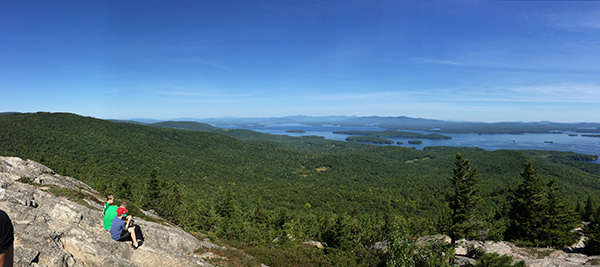 Photo by Jen Penningroth[/caption]
Instagram-worthy views
Photo by Jen Penningroth[/caption]
Instagram-worthy views -
Halibut Point State Park, Rockport, MA
Halibut Point State Park, Rockport, MA
When the skies are clear, this popular 2.5-mile seaside trail offers views as far as the Isle of Shoals, in New Hampshire; Crane Beach, in Ipswich; and Mount Agamenticus, in Maine.Level: Moderate | Distance from Boston: 43 miles Rockport, MA, 978-546-3120, website.
[caption id="attachment_2020354" align="aligncenter" width="600"]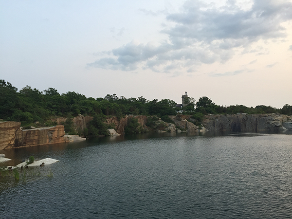 Photo by Jen Penningroth[/caption]
Instagram-worthy views
Dogs welcome
Photo by Jen Penningroth[/caption]
Instagram-worthy views
Dogs welcome -
Blue Hills Reservation, Skyline Trail, Milton, MA
Blue Hills Reservation, Skyline Trail, Milton, MA
This 7,000-acre park has six color-coded paths totaling 125 miles. If you want a challenge, follow the Skyline Trail for 5.7 miles over Tucker and Buck hills.Level: Moderate | Distance from Boston: 10 miles Milton, MA, 617-698-1802, website.
[caption id="attachment_2020347" align="aligncenter" width="600"] Photo by Melissa Malamut[/caption]
Good for youngsters
Dogs welcome
Trails for two-wheelers
Bring the canoe/paddle board
Photo by Melissa Malamut[/caption]
Good for youngsters
Dogs welcome
Trails for two-wheelers
Bring the canoe/paddle board -
Noanet Peak, Noanet Peak Trail, Dover, MA
Noanet Peak, Noanet Peak Trail, Dover, MA
Marked by yellow blazes, this 1.5-mile hike brings you to the summit of 387-foot-high Noanet Peak, from which you can catch Boston’s skyline.Level: Moderate | Distance from Boston: 22 miles Dover, MA, 508-785-0339 , website.
[caption id="attachment_2020348" align="aligncenter" width="600"]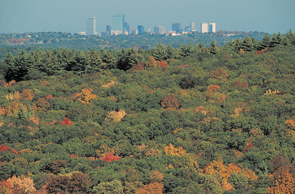 Photo courtesy of the Trustees[/caption]
Instagram-worthy views
Good for youngsters
Dogs welcome
Photo courtesy of the Trustees[/caption]
Instagram-worthy views
Good for youngsters
Dogs welcome -
Welch-Dickey Loop Trail, Mount Welch, Thornton, NH
Welch-Dickey Loop Trail, Mount Welch, Thornton, NH
This 4.5-mile hike along sheer rock faces ascends Mount Welch, which offers clear mountain tableaux. Level: Moderate Distance from Boston: 124 milesLevel: Moderate | Distance from Boston: 124 miles Thornton, MA, 603-536-6100, website.
[caption id="attachment_2020373" align="aligncenter" width="600"]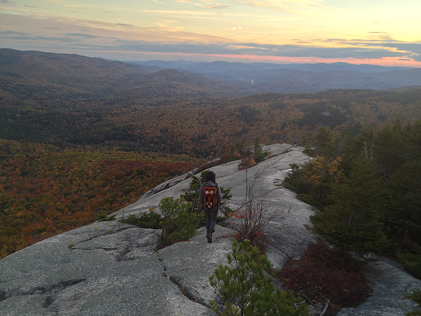 Photo by Ben Penningroth[/caption]
Instagram-worthy views
Photo by Ben Penningroth[/caption]
Instagram-worthy views -
Stratton Trail, Stratton Mountain, Stratton, VT
Stratton Trail, Stratton Mountain, Stratton, VT
Follow this 7.6-mile roundtrip route up to the peak of Stratton Mountain, where a fire tower offers glimpses of the Green Mountains.Level: Moderate | Distance from Boston: 148 miles Stratton, VT, 802-297-4000, website.
[caption id="attachment_2020380" align="aligncenter" width="600"] Photo by Nate Merrill on Flickr/Creative Commons[/caption]
Instagram-worthy views
Photo by Nate Merrill on Flickr/Creative Commons[/caption]
Instagram-worthy views -
Cheshire Harbor Trail, Mount Greylock, Lanesborough, MA
Cheshire Harbor Trail, Mount Greylock, Lanesborough, MA
At 6.6 miles roundtrip, this trail offers the easiest route up to the Bay State’s highest point—3,491-foot Mount Greylock—and can be completed in four to five hours.Level: Moderate | Distance from Boston: 151 miles Lanesborough, MA, 413-499-4262, website.
[caption id="attachment_2020381" align="aligncenter" width="600"]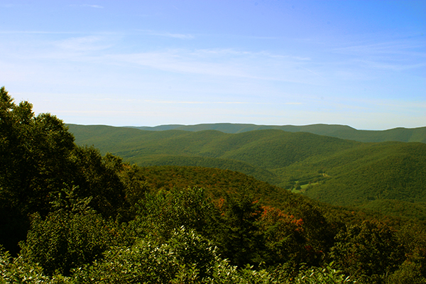 Photo courtesy Ryan Taylor on Flickr[/caption]
Instagram-worthy views
Trails for two-wheelers
Photo courtesy Ryan Taylor on Flickr[/caption]
Instagram-worthy views
Trails for two-wheelers -
Undermountain Trail, Bear Mountain, Salisbury, CT
Undermountain Trail, Bear Mountain, Salisbury, CT
This popular hike intersects the Appalachian Trail after about 2 miles. At the top of 2,316-foot Bear Mountain (the highest peak in Connecticut) is an old stone viewing tower.Level: Moderate | Distance from Boston: 151 miles Salisbury, CT, 203-788-7665, website.
[caption id="attachment_2020382" align="aligncenter" width="600"]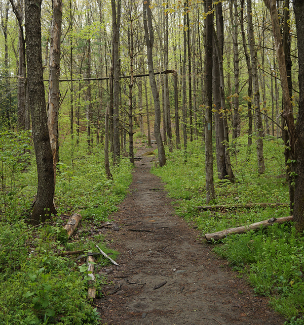 Photo courtesy of Dennis Cote on Flickr[/caption]
Instagram-worthy views
Photo courtesy of Dennis Cote on Flickr[/caption]
Instagram-worthy views -
Ramblewild, Lanesborough, MA
Ramblewild, Lanesborough, MA
Highlights of this four-season wonderland include guided hikes of the grounds and snowshoe rentals come winter.Level: Moderate | Distance from Boston: 152 miles Lanesborough, MA, 844-472-6253, website.
[caption id="attachment_2020383" align="aligncenter" width="600"]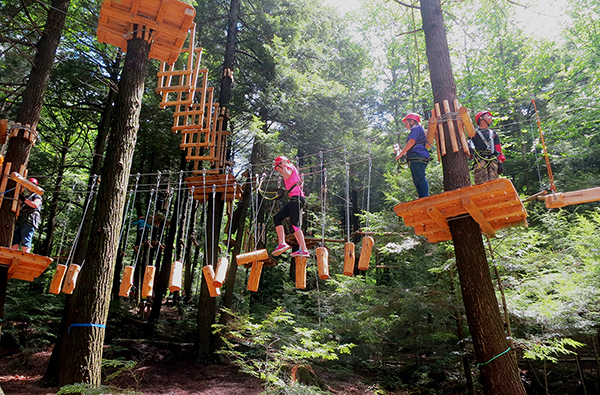 Photo via Ramblewild[/caption]
Instagram-worthy views
Photo via Ramblewild[/caption]
Instagram-worthy views -
Baldface Circle Trail, North and South Baldface, Chatham, NH
Baldface Circle Trail, North and South Baldface, Chatham, NH
A 9.8-mile trail with a 3,600-foot elevation gain, this hike ascends two peaks: North and South Baldface, each offering mountain panoramas.Level: Moderate | Distance from Boston: 160 miles Chatham, NH, 603-536-6100, website.
[caption id="attachment_2020384" align="aligncenter" width="600"] Photo by Sean Munson on Flickr/Creative Commons[/caption]
Instagram-worthy views
Photo by Sean Munson on Flickr/Creative Commons[/caption]
Instagram-worthy views -
Zealand and Twinway Trails, Mount Zealand, Jefferson, NH
Zealand and Twinway Trails, Mount Zealand, Jefferson, NH
This 5.6-mile hike up Mount Zealand begins on the Zealand Trail, then merges with the Twinway Trail, which leads to the impressive 25-foot Zealand Falls. About a mile later, you’ll reach an overhang known as Zeacliff, a choice spot for picnicking and soaking in the views.Level: Moderate | Distance from Boston: 161 miles Jefferson, NH, 603-745-8720, website.
[caption id="attachment_2020385" align="aligncenter" width="600"]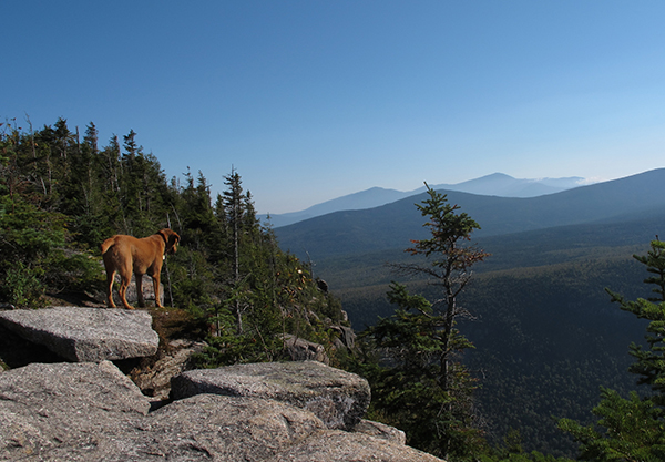 Photo courtesy of Elizabeth Kilmarx on Flickr[/caption]
Instagram-worthy views
Dogs welcome
Photo courtesy of Elizabeth Kilmarx on Flickr[/caption]
Instagram-worthy views
Dogs welcome -
Arethusa Falls Trail, Frankenstein Cliff, Hart’s Location, NH
Arethusa Falls Trail, Frankenstein Cliff, Hart’s Location, NH
This 5-mile loop winds its way up to Frankenstein Cliff. On the way down, the trail passes by 200-foot-high Arethusa Falls, New Hampshire’s highest waterfall.Level: Moderate | Distance from Boston: 168 miles Hart’s Location, NH, 603-374-2272, website.
[caption id="attachment_2020393" align="aligncenter" width="600"]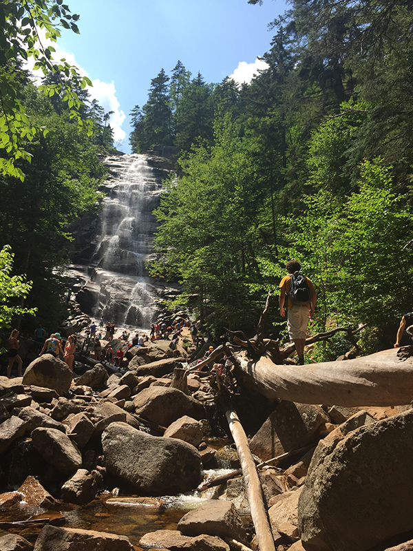 Photo by Jen Penningroth[/caption]
Instagram-worthy views
Good for youngsters
Photo by Jen Penningroth[/caption]
Instagram-worthy views
Good for youngsters -
Woods Loop Trail, Beech Hill, Rockport, ME
Woods Loop Trail, Beech Hill, Rockport, ME
This forest path offers a gradual climb up Beech Hill, the only treeless hilltop in the area, revealing views of the St. George Peninsula, the Camden Hills, and Penobscot Bay.Level: Moderate | Distance from Boston: 187 miles Rockport, ME, 207-236-7091, website.
[caption id="attachment_2020396" align="aligncenter" width="600"] Photo by Fyn Kynd Photography on Flickr/Creative Commons[/caption]
Instagram-worthy views
Good for youngsters
Photo by Fyn Kynd Photography on Flickr/Creative Commons[/caption]
Instagram-worthy views
Good for youngsters -
Mount Battie Trail, Mount Battie, Camden, ME
Mount Battie Trail, Mount Battie, Camden, ME
A 0.5-mile trek leads you to the summit of Mount Battie, known for its steep ledges and ocean views. The trail is one of 20 hikes offered at Camden Hills State Park.Level: Moderate | Distance from Boston: 190 miles Camden, ME, 207-236-0849, website.
[caption id="attachment_2020397" align="aligncenter" width="600"]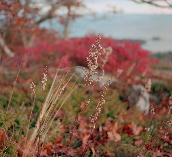 Photo courtesy of Jason Philbrook on Flickr[/caption]
Instagram-worthy views
Trails for two-wheelers
Photo courtesy of Jason Philbrook on Flickr[/caption]
Instagram-worthy views
Trails for two-wheelers -
Stowe Pinnacle Trail, Pinnacle Peak, Stowe, VT
Stowe Pinnacle Trail, Pinnacle Peak, Stowe, VT
The 1.4-mile trail climbs 1,520 feet to the top of the Pinnacle peak, where you’ll find panoramas of Stowe and the surrounding mountains.Level: Moderate | Distance from Boston: 203 miles Stowe, VT, 802-244-7037, website.
[caption id="attachment_2020398" align="aligncenter" width="600"] Photo courtesy of Tim Bentley on Flickr[/caption]
Instagram-worthy views
Photo courtesy of Tim Bentley on Flickr[/caption]
Instagram-worthy views -
Kingdom Trails, Bear Back Trail, East Burke, VT
Kingdom Trails, Bear Back Trail, East Burke, VT
The large Kingdom Trails network boasts hiking, mountain-biking, snowshoeing, and cross-country-skiing routes for adventurers of all ages. New this season is the Bear Back trail, a one-mile mountain-biking route.Level: Moderate | Distance from Boston: 185 miles East Burke, VT, 802-626-0737, website.
[caption id="attachment_2020405" align="aligncenter" width="600"]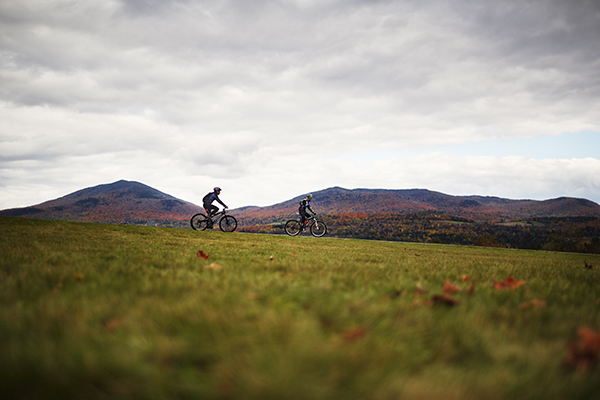 Photo by Jonathan Kozowyk for Boston Magazine[/caption]
Instagram-worthy views
Good for youngsters
Trails for two-wheelers
Photo by Jonathan Kozowyk for Boston Magazine[/caption]
Instagram-worthy views
Good for youngsters
Trails for two-wheelers -
Chasm Loop Trail, Purgatory Chasm State Reservation, Sutton, MA
Chasm Loop Trail, Purgatory Chasm State Reservation, Sutton, MA
Admire five rock formations: Devil’s Coffin, Fat Man’s Misery, Devil’s Corncrib, Devil’s Pulpit, and Lover’s Leap—a chasm surrounded by granite walls as high as 70 feet—along this half-mile trek.Level: Moderate | Distance from Boston: 49 miles Sutton, MA, 508-234-3733, website.
[caption id="attachment_2020408" align="aligncenter" width="600"] Photo by Troy B Thompson on Flickr/Creative Commons[/caption]
Good for youngsters
Photo by Troy B Thompson on Flickr/Creative Commons[/caption]
Good for youngsters -
West Ridge Trail, Mount Cardigan, Orange, NH
West Ridge Trail, Mount Cardigan, Orange, NH
This is the most direct route up 3,121-foot Mount Cardigan, a treeless area offering unobstructed views of Mount Monadnock, the White Mountains, Maine’s Pleasant Mountain, and Camel’s Hump, in Vermont.Level: Moderate | Distance from Boston: 120 miles Orange, NH, 603-227-8745, website.
[caption id="attachment_2020415" align="aligncenter" width="600"] Photo by Michael Tsai on Flickr/Creative Commons[/caption]
Instagram-worthy views
Photo by Michael Tsai on Flickr/Creative Commons[/caption]
Instagram-worthy views -
Mattatuck Trail, Mattatuck State Forest, Thomaston, CT
Mattatuck Trail, Mattatuck State Forest, Thomaston, CT
The Mattatuck Trail runs 36 miles through the 4,510-acre Mattatuck State Forest, passing a rock formation known as the Leatherman Cave along the way.Level: Moderate | Distance from Boston: 138 miles Thomaston, CT, 860-567-5694, website.
[caption id="attachment_2020417" align="aligncenter" width="600"] Photo by Kenneth Casper on Flickr/Creative Commons[/caption]
Trails for two-wheelers
Photo by Kenneth Casper on Flickr/Creative Commons[/caption]
Trails for two-wheelers -
Battell Trail, Mount Abraham, Lincoln, VT
Battell Trail, Mount Abraham, Lincoln, VT
The Battell Trail—which turns into the Long Trail—is a 5.8-mile round-trip hike to the summit of Mount Abraham, from which you can admire the White Mountains, Killington Peak, and the Adirondacks.Level: Moderate | Distance from Boston: 200 miles Lincoln, VT, website.
[caption id="attachment_2020421" align="aligncenter" width="600"] Photo by DVS on Flickr/Creative Commons[/caption]
Instagram-worthy views
Photo by DVS on Flickr/Creative Commons[/caption]
Instagram-worthy views -
Long Trail, Belvidere Mountain, Belvidere, VT
Long Trail, Belvidere Mountain, Belvidere, VT
Bordered by rich vegetation—trout lilies, trilliums—this route takes you 3.6 miles up to the summit of Laraway Mountain. There you’ll be able to see Lake Champlain and the Sterling and Mansfield Mountain ranges.Level: Moderate | Distance from Boston: 226 miles Belvidere, VT, 802-244-7037, website.
[caption id="attachment_2020423" align="aligncenter" width="600"] Photo by Charles Wohlers on Flickr/Creative Commons[/caption]
Instagram-worthy views
Photo by Charles Wohlers on Flickr/Creative Commons[/caption]
Instagram-worthy views -
Bay Circuit Trail, Mount Misery, Lincoln, MA
Bay Circuit Trail, Mount Misery, Lincoln, MA
Located within the Lincoln Conservation, this 3-mile walk leads up 285-foot-high Mount Misery; from its peak, you can see Fairhaven Bay and Sudbury River.Level: Moderate | Distance from Boston: 20 miles Lincoln, MA, 978-470-1982, website.
Instagram-worthy views
Dogs welcome
Trails for two-wheelers -
Busby Trail, Spruce Hill, Florida, MA
Busby Trail, Spruce Hill, Florida, MA
Located in the Savoy Mountain State Forest, this 3-mile loop scales Spruce Hill, rewarding you with panoramas of Hoosac Valley. Multiple clearings provide places to watch migrating hawks.Level: Moderate | Distance from Boston: 135 miles Florida, MA, 413-664-4800, website.
Trails for two-wheelers

Advanced
-
Presidential Traverse, Presidential Range, Gorham, NH
Presidential Traverse, Presidential Range, Gorham, NH
Best in late spring through early fall, the Presidential Traverse is a roughly 23-mile trek, typically completed in two to four days, that crosses all seven peaks in the Presidential Range.Level: Advanced | Distance from Boston: 176 miles Gorham, NH, 603-466-3347, website.
[caption id="attachment_2020395" align="aligncenter" width="600"]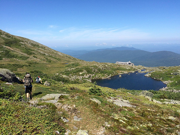 Photo courtesy of Greg Howard[/caption]
Instagram-worthy views
Photo courtesy of Greg Howard[/caption]
Instagram-worthy views -
Weathersfield Trail, Mount Ascutney, Weathersfield, VT
Weathersfield Trail, Mount Ascutney, Weathersfield, VT
The Weathersfield Trail climbs 2.9 miles up to the summit of Mount Ascutney. Along the way, you’ll pass the Crystal Cascade Falls, Gus’s Lookout (where hang gliders launch in summer), and a 24-foot observation tower.Level: Advanced | Distance from Boston: 125 miles Weathersfield, VT, 802-674-2060, website.
[caption id="attachment_2020375" align="aligncenter" width="600"] Photo by Miguel Vieira on Flickr/Creative Commons[/caption]
Instagram-worthy views
Photo by Miguel Vieira on Flickr/Creative Commons[/caption]
Instagram-worthy views -
South Ridge Trail, Cadillac Mountain, Mount Desert Island, ME
South Ridge Trail, Cadillac Mountain, Mount Desert Island, ME
It gets steep as you approach the summit of Cadillac Mountain on this 7.4-mile roundtrip hike in Acadia National Park, but the path provides stunning glimpses of the Atlantic and, at night, a clear shot of the Milky Way.Level: Advanced | Distance from Boston: 285 miles Mount Desert Island, ME, 207-288-3338, website.
[caption id="attachment_2020399" align="aligncenter" width="600"] Photo by Paul VanDerWerf on Flickr/Creative Commons[/caption]
Instagram-worthy views
Photo by Paul VanDerWerf on Flickr/Creative Commons[/caption]
Instagram-worthy views -
Mount Moosilauke, Beaver Brook or Glencliff Trails, Benton, NH
Mount Moosilauke, Beaver Brook or Glencliff Trails, Benton, NH
Take the Beaver Brook or Glencliff trails to meet the Appalachian Trail, which scales 4,802-foot Mount Moosilauke. From the summit, you’ll get a 360-degree view of the Green Mountains, Franconia Ridge, and more.Level: Advanced | Distance from Boston: 147 miles Benton, NH, website.
[caption id="attachment_2020378" align="aligncenter" width="600"] Photo by Jen Penningroth[/caption]
Instagram-worthy views
Photo by Jen Penningroth[/caption]
Instagram-worthy views -
Tuckerman’s Ravine Trail, Mount Washington, Pinkham Notch, NH
Tuckerman’s Ravine Trail, Mount Washington, Pinkham Notch, NH
Follow this 6-mile roundtrip hike to reach the summit of Mount Washington—at 6,288 feet, the Northeast’s highest peak—which offers peerless vistas extending into Vermont, Massachusetts, Québec, New York, and the Atlantic.Level: Moderate to Advanced | Distance from Boston: 167 miles Pinkham Notch, NH, 603-466-3347, website.
[caption id="attachment_2020386" align="aligncenter" width="600"]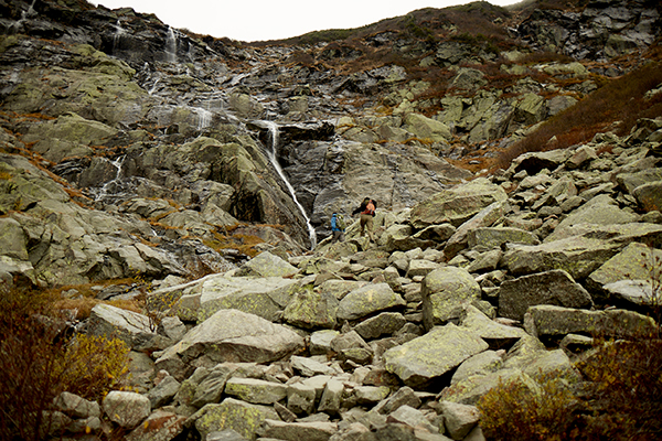 Photo by Jonathan Kozowyk for Boston Magazine[/caption]
Instagram-worthy views
Photo by Jonathan Kozowyk for Boston Magazine[/caption]
Instagram-worthy views -
White Dot Trail, Mount Monadnock, Jaffrey, NH
White Dot Trail, Mount Monadnock, Jaffrey, NH
This 1.66-mile hike up the 3,165-foot-high (and very windy) Mount Monadnock is one of the most popular trails in North America, so go on a weekday to avoid the crowds.Level: Advanced | Distance from Boston: 84 miles Jaffrey, NH, 603-532-8862, website.
[caption id="attachment_2020360" align="aligncenter" width="600"]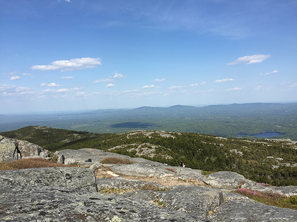 Photo by Jen Penningroth[/caption]
Instagram-worthy views
Photo by Jen Penningroth[/caption]
Instagram-worthy views -
Bondcliff Trail, West Bond, Lincoln, NH
Bondcliff Trail, West Bond, Lincoln, NH
This 23-mile looping hike, which begins at the Lincoln Woods Visitor Center, usually takes two days if you travel all the way to West Bond peak.Level: Advanced | Distance from Boston: 137 miles Lincoln, NH, 603-536-6100, website.
[caption id="attachment_2020376" align="aligncenter" width="600"] Photo by Tim Sackton on Flickr/Creative Commons[/caption]
Instagram-worthy views
Photo by Tim Sackton on Flickr/Creative Commons[/caption]
Instagram-worthy views -
Knife Edge Trail, Mount Katahdin, Millinocket, ME
Knife Edge Trail, Mount Katahdin, Millinocket, ME
The challenging 1.1-mile Knife Edge Trail traverses the completely exposed ridge of Mount Katahdin. Here you’ll find the northern terminus of the 2,180-mile Appalachian Trail, which runs from Georgia to Maine.Level: Advanced | Distance from Boston: 306 miles Millinocket, ME, 207-723-5140, website.
[caption id="attachment_2020400" align="aligncenter" width="600"] Photo by Alex Kerney on Flickr/Creative Commons[/caption]
Instagram-worthy views
Photo by Alex Kerney on Flickr/Creative Commons[/caption]
Instagram-worthy views -
Precipice Trail, Acadia National Park, Mount Desert Island, ME
Precipice Trail, Acadia National Park, Mount Desert Island, ME
Located on the east side of Champlain Mountain in Acadia National Park, this 1,058-foot ascent across an open rock face would be a technical climb if it weren’t for the handrails and ladders provided to assist hikers. The trail closes periodically in the summer for the protection of endangered peregrine falcons.Level: Advanced | Distance from Boston: 285 miles Mount Desert Island, ME, 207-288-3338, website.
[caption id="attachment_2020401" align="aligncenter" width="600"]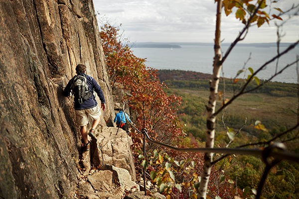 Photo by Jonathan Kozowyk for Boston Magazine[/caption]
Instagram-worthy views
Photo by Jonathan Kozowyk for Boston Magazine[/caption]
Instagram-worthy views -
Mount Norwottuck and Horse Caves Trail, Mount Holyoke State Park, Amherst, MA
Mount Norwottuck and Horse Caves Trail, Mount Holyoke State Park, Amherst, MA
This 3.2-mile stretch of the Metacomet-Monadnock Trail leads to the top of 1,106-foot Mount Norwottuck. On the way back, pass by the Horse Caves (more like ledges than caverns) and continue on to the Robert Frost Trail.Level: Advanced | Distance from Boston: 90 miles Amherst, MA, 413-253-2883, website.
[caption id="attachment_2020414" align="aligncenter" width="600"] Photo by Paul Cooper on Flickr/Creative Commons[/caption]
Trails for two-wheelers
Photo by Paul Cooper on Flickr/Creative Commons[/caption]
Trails for two-wheelers -
Main Loop, Mine Hill Preserve, Roxbury, CT
Main Loop, Mine Hill Preserve, Roxbury, CT
This 3.5-mile looping trail through Mine Hill Preserve passes abandoned mine tunnels, airshafts, and old quarries.Level: Advanced | Distance from Boston: 149 miles Roxbury, CT, 860-350-4148, website.
[caption id="attachment_2020418" align="aligncenter" width="600"] Photo by Logan Ingalls on Flickr/Creative Commons[/caption]
Instagram-worthy views
Photo by Logan Ingalls on Flickr/Creative Commons[/caption]
Instagram-worthy views -
Gifford Woods State Park, Killington, VT
Gifford Woods State Park, Killington, VT
Two major routes—the Appalachian Trail and Long Trail—meet in this park, which also offers the popular one-mile Kent Brook trail and the 0.3-mile Interpretive Trail, featuring interactive exhibits.Level: Moderate to Advanced | Distance from Boston: 173 miles Killington, VT, 802-775-5354, website.
[caption id="attachment_2020419" align="aligncenter" width="600"] Photo by Jonathan Kozowyk for Boston Magazine[/caption]
Instagram-worthy views
Photo by Jonathan Kozowyk for Boston Magazine[/caption]
Instagram-worthy views -
Camel’s Hump State Park, Waterbury, VT
Camel’s Hump State Park, Waterbury, VT
At 18.7 miles, the Long Trail is recommended for experience hikers. For more-accessible Green Mountain views, try the Camel’s Hump View Trail (0.8 miles) up to Vermont’s third-highest peak.Level: Advanced | Distance from Boston: 200 miles Waterbury, VT, 802-879-6565, website.
[caption id="attachment_2020420" align="aligncenter" width="600"] Photo by Thomson20192 on Flickr/Creative Commons[/caption]
Instagram-worthy views
Photo by Thomson20192 on Flickr/Creative Commons[/caption]
Instagram-worthy views -
Sunset Ridge Trail, Mount Mansfield, Underhill, VT
Sunset Ridge Trail, Mount Mansfield, Underhill, VT
Viewed from the east, Mount Mansfield, with its four summits—the Adam’s Apple, at 4,060 feet; the Chin, at 4,393 feet; the Nose, at 4,062 feet; and the Forehead, at 3,940 feet—resembles a human face. It’s accessible via multiple trails; take the 3-mile Sunset Ridge Trail to scale the Chin.Level: Advanced | Distance from Boston: 221 miles Underhill, VT, 802-899-3022, website.
[caption id="attachment_2020422" align="aligncenter" width="600"] Photo by RedJar on Flickr/Creative Commons[/caption]
Instagram-worthy views
Photo by RedJar on Flickr/Creative Commons[/caption]
Instagram-worthy views -
Firewarden’s Trail and Horns Pond Trail, Bigelow Preserve, Stratton, ME
Firewarden’s Trail and Horns Pond Trail, Bigelow Preserve, Stratton, ME
Standing at 4,088 feet, Avery Peak offers 360-degree vistas of Flagstaff Lake from the top.Level: Advanced | Distance from Boston: 241 miles Stratton, ME, 207-778-8231, website.
[caption id="attachment_2020424" align="aligncenter" width="600"] Photo by Chris M Morris on Flickr/Creative Commons[/caption]
Instagram-worthy views
Photo by Chris M Morris on Flickr/Creative Commons[/caption]
Instagram-worthy views
Map
Which hikes are family-friendly? Good for dogs? Instagram-worthy? Use our interactive map to find your perfect escape with ease. Locations are approximate, please consult websites for exact directions.
#BoMagHikes
Before lacing up your hiking boots, check out these pics of fun on the trails. Tag your own Instagram photos with #BoMagHikes to share your adventures.
More Stories
From bird watching to what to wear, here are our guides to hiking smart and looking sharp.
-
10 Places to Go for a Hike This Summer in Massachusetts
-
Spend a Day Hiking, Picnicking, and Stargazing on a Central Massachusetts Day Trip
-
Explore Seaside Trails and Outdoor Art on a South Coast Day Trip
-

Early Spring Hikes to Enjoy across New England
-

Guide: What to Eat Before and During a Hike
-

What to Wear on a Hike
-

Edible Plants You'll Find in the Wild
-

Five Tips for Thwarting Ticks
-
Five Animals to Watch Out For
-

The New England-Made Gear Guide
-
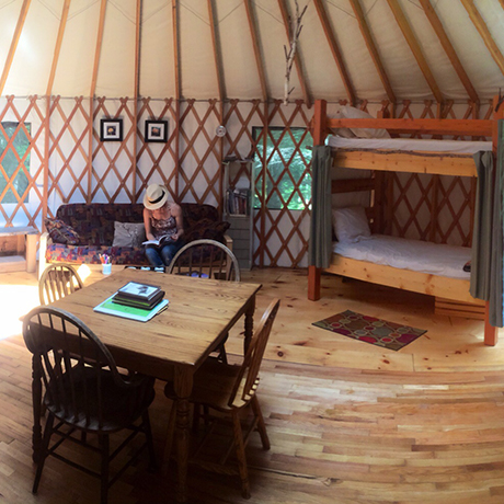
A Guide to Glamping
-

Best Places to Go Bird-Watching
Credits
Hikes list by Melissa Malamut and Asia Bradlee. Additional stories by Melissa Malamut, Kara Baskin, Jamie Ducharme, Brittany Jasnoff, and Andrea Timpano. Lead photo by Jonathan Kozowyk. Produced by Sean Megan, Jen Penningroth, and Yiqing Shao.