Is Boston Facing a New Orleans-Type Flood?
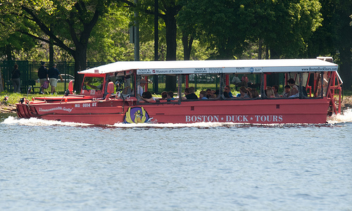
 When the floods come, this will be your method of transportation. (Photo via Flickr/photofarmer)
Get out your Wellingtons, everyone: Boston is facing a very wet future. The US Geological Survey published a study over the weekend showing that water levels in the Northeast are, per the Globe, “rising three to four times faster than the global average, and coastal cities, utilities, beaches, and wetlands are increasingly vulnerable to flooding, especially from storm surges …”
That’s bad news. Really bad news. Much of sea-level Boston was constructed by land reclamation, in which our urban ancestors filled in the marshy areas around the original Shawmut Peninsula. We expanded our footprint to include the Back Bay, Fenway-Kenmore, the South End, and South Boston. Little surprise, then, that those areas are particularly prone to flooding:
In Boston, officials have begun mapping low-lying areas and critical systems that are most likely to be inundated. The maps show that if sea levels rise just 2.5 feet, it could take little more than a Nor’easter to put much of the Back Bay, East Boston, South Boston, Chelsea, Cambridge, and elsewhere underwater, including much of Logan International Airport and the financial district.
Yes: A Nor’Easter could flood a good portion of the city of Boston.
Thankfully, the city and state are taking the right steps by inspecting sewer/draining systems, working with business owners to increase energy efficiency, and encouraging developers to take rising sea levels into account when planning new buildings. Those actions will help deal with the rising sea levels locally, but realistically, we need a global movement to help stem climate change. Mayor Menino is the most powerful guy around, but all we can really do is prepare to deal with the rising levels. That, and issue an order to commandeer all the duck boats!

