Region Hunkers down for Blast of Snow from Winter Storm Mars
National Weather Service
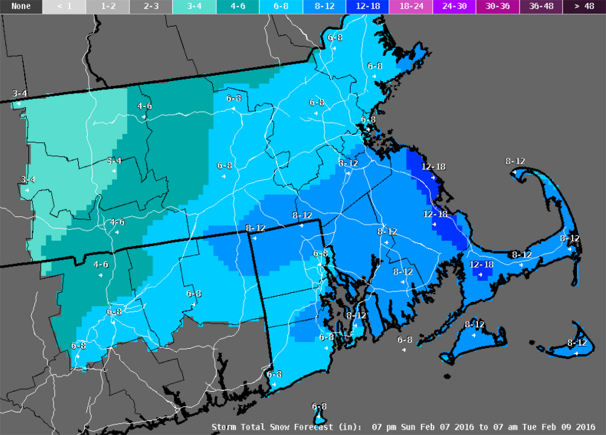
Another major snowstorm is set to blast the Greater Boston region with 6-10 inches of the white stuff. The storm will also pound the beaches with rough seas and knock things around with wind gusts that could top 65 miles per hour. The latest snowstorm, dubbed Winter Storm Mars, has prompted closures throughout the area, creating a four-day weekend for many.
The National Weather Service is reporting the storm will bring blizzard conditions to the southeastern portion of the state, especially the South Shore, where over a foot of snow is expected in some isolated local areas. Coastal flooding is likely to occur during high tide in coastal areas to the south of Boston. The heaviest snowfall is expected to fall in the morning and early afternoon.
With heavy snowfall and winds expected in the 45-65 MPH range, whiteout conditions will occur in some areas, making travel nearly impossible. It is very likely the early snow will be wet, raising the probability of power outages and tree falls in the region.
The storm is off to a much later start than initially anticipated, but is still expected to last through the evening.
The latest thinking from NWS:
Please RT: Our morning update for the storm across the region today. Lot’s of wind, some pockets of heavy snow! pic.twitter.com/4KMPUz9apR
— NWS Boston (@NWSBoston) February 8, 2016
The long range forecast from NWS:
A powerful ocean storm off the North Carolina coast early this morning will move northeast and bring heavy snow. Strong winds and coastal flooding to eastern New England into early this evening. Additional shortwaves move past New England Tuesday through Thursday maintaining clouds and a chance of snow showers. An arctic cold front will cross the region Thursday…followed by dry air and colder than normal temperatures for the weekend.
[830a] Snow increasing in coverage. Visibilities dropping, roads becoming slick pic.twitter.com/Vp43ADU230
— NWS Boston (@NWSBoston) February 8, 2016