Nor’easter Bombards Boston with Heavy Rain and Wind Gusts
A March storm is battering the coast.
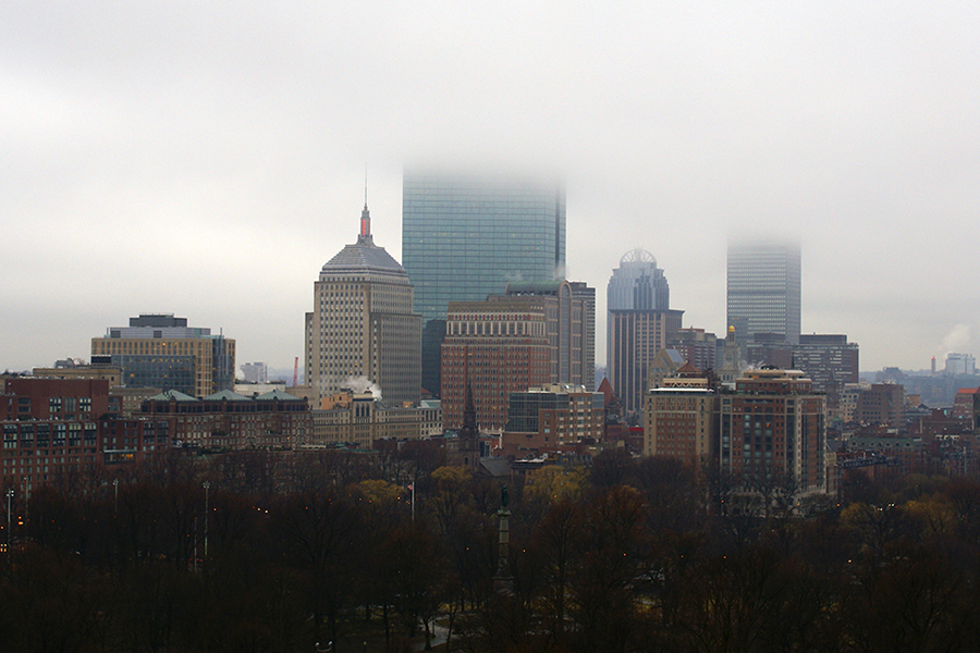
Photo via iStock/sorsillo
With reporting by Lisa Weidenfeld, Spencer Buell, and Hayley Glatter.
Update 5:45 p.m.
After a day of widespread coastal flooding, the National Weather Service is warning that the worst tides are yet to come, with “near record breaking” levels anticipated overnight as high tide returns at 11:45 p.m.
[Tide Forecasts as of 4p] GREATEST CONCERN TONIGHT; wind / wave / surge = near record breaking tides, damage to vulnerable shoreline homes; thru multiple high tide cycles, persistent NE winds & surge, some coastal locations likely to remain inundated, cutoff for a period of time pic.twitter.com/IxOBH5NVWM
— NWS Boston (@NWSBoston) March 2, 2018
Many flights have been canceled at Logan as rain and high winds continue to whip the airport.
Due to weather, many airlines are cancelling flights. Please check with your airline for the latest information about your flight before heading to Logan.
— Boston Logan Airport (@BostonLogan) March 2, 2018
Those hoping to take the Amtrak are similarly out of luck. Service has been canceled for the entire Northeast corridor due to “hazardous conditions,” Amtrak says.
Despite our best effort to restore service between BOS and WAS today, we have determined at this time it is not safe to do so. Hazardous conditions for our customers & crews have led us to cancel all Amtrak service on the Northeast Corridor until tomorrow. We sincerely apologize.
— Amtrak Northeast (@AmtrakNEC) March 2, 2018
But some people are, apparently, making the most of the situation. Like this man, seen “surfing” through an inundated Fort Point.
VIDEO: Surfing down Farnsworth Street, Fort Point, Boston. Courtesy of @DaveEverett. cc @universalhub pic.twitter.com/pTvTjajNrA
— The Fort Pointer (@FortPointer) March 2, 2018
Update 2:35 p.m.
After the storm, the Boston Climate Action Network says it plans to hold a rally outside the Aquarium MBTA stop on Sunday, March 4, at 1 p.m., where they’ll call for the city to better prepare for sea level rise caused by climate change.
Among their goals is to push the city to more quickly implement Community Choice Energy, the program approved by the City Council and signed by Mayor Marty Walsh last year that would let many Boston ratepayers get their power from renewable sources (bills would go up a few dollars a year, and residents would have the option to back out). The city is in the process of doing so but Boston’s energy chief, Austin Blackmon, has said it could take up to two years.
“We need to be taking action to stop climate change from getting worse, cutting our carbon emissions and moving faster,” says Any Bean, the group’s campaign coordinator. “One of the best ways we can do that is to implement Community Choice as soon as possible.”
Bean says they will also call for a moratorium on new construction along the East Boston waterfront until neighbors there can be assured that building projects have taken rising sea levels into account, and that better flood mitigation plans are in place.
It’s just a coincidence that the rally will come just after the storm recedes, Bean says. It was originally planned in the wake of flooding in January. “It’s been planned for some time,” he says. “We saw the flooding on January 4th and knew it was going to happen again. We didn’t know it was going to happen so close to the day we picked.”
Update 1:55 p.m.
Yikes! Police reported a pretty close call in Tewksbury after wind from the storm knocked a large tree onto the roof of a car. The driver is expected to be alright, and was taken to the hospital with non life-threatening injuries, police said in a tweet, along with a photo of the extensive damage.
East St will remain closed until the tree and utilities are cleared from the road. Sole occupant of this vehicle was transported by @TewksburyFire w/apparent non life threatening injuries. #Tewksbury TPD47 pic.twitter.com/RjjmP6vwZo
— Tewksbury Police (@TewksburyPD) March 2, 2018
Update 1:49 p.m.
Over 62,000 people in Massachusetts are without power, according to the state Emergency Management Agency. Though intermittent outages have been reported throughout the state, blackouts are the most widespread in Bristol, Plymouth, and Barnstable counties. Officials said additional outages are possible, as the storm continues to slam the region.
~45K power outages as of 1:15 PM.
Additional power outages may occur through the storm.
Outage tracking map: https://t.co/tKdER1Llac
Power outage safety tips: https://t.co/7KtWzMhiMZ pic.twitter.com/BUm7Q23Bed— MEMA (@MassEMA) March 2, 2018
Amtrak also suspended service along the busy northeastern corridor route due to flooding, high winds, and downed trees. Trains that are already on their way will be held at the nearest station, the company said on Twitter.
ALERT: For safety, all services along the NEC are temporarily suspended due to multiple weather related issues. Trains enroute will continue to WAS/NYP/BOS (whichever is first) and hold. We apologize for this inconvenience and will be providing updates as soon as possible.
— Amtrak Northeast (@AmtrakNEC) March 2, 2018
Update 1:30 p.m.
The National Weather Service has updated its forecast of what to expect as the storm gets a little chillier overnight. Boston is expected to see one-to-two inches of snow Friday night into Saturday morning, the NWS says, while Fitchburg could see 4-6 inches and parts of Western Mass could see 12-18 inches.
WINTER WEATHER ADVISORIES expanded; include areas @ RI; expectation towards this evening that under the storm intensity, beginning to pull away, cold air wraps in changing the heavy rain to a pasty, heavy wet snow … plus winds, increased threat of downed limbs, power outages pic.twitter.com/LUzEIxS6ma
— NWS Boston (@NWSBoston) March 2, 2018
Update 12:15 p.m.
In Quincy, front-end loaders have been called in to help transport people who’ve gotten stuck trying to navigate flooded streets. Police are urging people to stay in their homes as long as it’s safe, and stay off the road.
Rescues continue across the city. Front-end loaders needed to assist, as our vehicles are unable to navigate the water. We can not repeat it enough… please stay where you are if it is safe. @CityofQuincy pic.twitter.com/gDMCVRwBfJ
— Quincy Police (@quincymapolice) March 2, 2018
Ladies and gentlemen.. PLEASE… This not only endangers your life, but the lives of first responders #TurnAroundDontDrown pic.twitter.com/qfAsec4Xoz
— Quincy Police (@quincymapolice) March 2, 2018
Meanwhile, video taken in the Seaport appears to show water gushing down a building’s stairwell.
Buildings are flooding in Boston’s Seaport District right now.
📹: @WeaponXJuno pic.twitter.com/LbOwN83eR2
— Only In Boston (@OnlyInBOS) March 2, 2018
Update 12:03 p.m.
As Boston reached high tide at 11:15 a.m., streets around the metro area transformed into thoroughfares better suited for boats than for cars. Flood waters rushed through the Seaport and elsewhere, and a series of downed power lines prompted road closures in Watertown.
Brave driver trying to escape Seaport area right at high tide. #boston #noreaster #boston pic.twitter.com/ZbpiAMSs84
— David Caruso (@dac303) March 2, 2018
@ABC7 @7News @boston25 @cnnireport @cnni @USATODAY @OnlyInBOS @FOX25Weather @weatherchannel @accuweather #CNNWeather pic.twitter.com/wA5ZNTxcrq
— Matthew Nguyen (@MattyIce_978) March 2, 2018
Please avoid Arsenal St until further notice. pic.twitter.com/sCKFJK8aqt
— Watertown Police (@WatertownPD) March 2, 2018
Mass cancellations have swept through Logan Airport, where nearly 500 flights have been affected, according to the tracking website FlightAware.
Update 11:05 a.m.
MBTA crews continue to respond as heavy winds down trees and floodwater approaches T stops and interrupts service.
Passengers were shuttled on buses between Brookline Hills and Brookline Village on the D Line after a tree limb was blown onto the tracks after 10 a.m. Service resumed with delays at 10:53 a.m., according to the T’s twitter account.
Downed tree on the overhead wire has been confirmed btwn Brookline Hills & Brookline Village.
Bus shuttles will run in both directions btwn Fenway & Reservoir. Expect delays as buses are sent. pic.twitter.com/1Xof79arW6— MBTA (@MBTA) March 2, 2018
As an 11:15 high tide approaches, water can be seen surrounding the Aquarium MBTA stop. Trains are “no longer making stops” at the station according to MBTA spokesman Joe Pesaturo, who shared video of water dripping into it.
#MBTA #BlueLine trains are no longer making stops at #Aquarium Station pic.twitter.com/24klCN7zMx
— Joe Pesaturo (@JoePesaturo) March 2, 2018
Water has wrapped around to State st. side of #aquarium T stop. Sandbags seem to be holding for now. @7News pic.twitter.com/0gKAcxRbxq
— Kim Lucey (@KimLucey) March 2, 2018
The T said earlier this morning that it was “planning for significant impacts to the Rockport/Newburyport and Haverhill commuter rail lines, as well as the Blue Line.”
Update 10:45 a.m.
Flooding has already started at various points along the harbor.
Flooding at long wharf. @NWSBoston pic.twitter.com/DbEUcxMq2R
— Rob Walsh (@Robbowalshie) March 2, 2018
Fort Point Channel already overtopped its banks, water about a foot from the Summer Street Bridge. And still an hour til high tide. pic.twitter.com/wgXLAWhJCc
— Tim Logan (@bytimlogan) March 2, 2018
Earlier…
Brace yourselves, Boston: The current storm is a nasty one. Torrential rain and strong winds are currently battering the area, and the Washington Post says today’s nor’easter could involve “once in a generation flooding.” Blame tonight’s full moon for what they’re calling “a worst case-scenario coastal flood event.”
Governor Charlie Baker, never one for exaggeration, warned residents yesterday that the storm was likely to be a bad one, saying, “I can’t stress this enough: This isn’t a snowstorm in eastern Mass., but the storm itself, especially along the coast, is shaping up to be more severe than the storm on January 4.” He’s activated the National Guard to help respond, and the National Weather Service has been busy tweeting out updates on the storm, with wind gusts over 50 mph already reported.
Meteorologists predict that as the storm intensifies, the rain will eventually turn to snow, with western Massachusetts potentially seeing nearly a foot. Boston should expect a 2-inch dusting later this evening, with a worst-case scenario of 7 inches accumulating here.
The previous bomb cyclone dumped a mix of snow and rain on the area, and created rivers in the Seaport.
We’ll be keeping this post updated throughout the day with updates on the storm. Stay safe, everyone.
Already waves starting to crash through guardrail an hour before high tide here on Seaport Blvd near World Trade Center @7News #Boston #Weather #News pic.twitter.com/L2yZjaj3Uo
— David Tanklefsky (@davidtanklefsky) March 2, 2018
The storm just beginning – but the flooding already starting on Long Wharf in Boston. @NBC10Boston @NECN pic.twitter.com/028Ulrajfw
— Abbey Niezgoda NBC10 Boston (@AbbeyNBCBoston) March 2, 2018
[8a] WHAT A BEAST! GOES-16 set in 1-minute scan mode; check it out: https://t.co/q8KnWbZaMq #satellites #GOES16 pic.twitter.com/Gp3LljTQEp
— NWS Boston (@NWSBoston) March 2, 2018
[HEAVY WET SNOW] Berkshires all snow while a change to rain elsewhere at first, but as the storm strengthens, intensifies, expecting a change back over to snow late today into this evening; up to a foot of snow possible; impacts exacerbated w/ forecast NE @ 30-60 mph winds pic.twitter.com/2ZP4x5AuCr
— NWS Boston (@NWSBoston) March 2, 2018